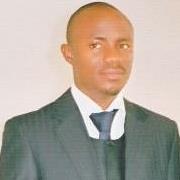
About ADEWARA, MONSUR BABALOLA
Lecturer I|ND, BSc.,MSc.PhD Surveying and Geoinformatics (In view)
School
SCHOOL OF ENVIRONMENTAL STUDIES
Department
Surveying and Geoinformatics
Programme
National Diploma & Higher National Diploma
Research Interest
GIS, Remote Sensing, Flood Hydraulic/Hydrological modeling
Teaching Areas
Principles of Geoinformatics
Database Creation & Usage in Geoinformatics,
Geographic Information System (GIS) Tools,
Computer Application in Surveying
Computer Application in Planning
Hydrographical Surveying
Topographical Surveying
Selected Publications
Adedokun, A.M & Adewara, M.B. (2016)“Applicationof GIS Technology to Electrical Infrastructure Management (Case study of Ilaro town)”International Journal of Socioeconomic development and strategic studies (IJOSEDASS), Pp 358-368, Vol 8 No 1
Adewara, M.B. Adedokun A.M (2016) “Health Impact Assessment of Road Rehabilitation on Air andNoise(A case study of Mile 12 – Ikorodu Express road”. International Journal of Management Sciences (IJOMAS), Pp 89-102, Vol. 9 No 1.
Adedokun, A.M. and Adewara, M.B. (2016). “Assessment of Health care facilities and management in Enugu State Nigeria. A GIS Approach”.Ilaro Journal of Environmental Research and Development (Volume 2 No.1 2016).
Conferences Attended
Adewara, M.B. (2019)“An investigation into the flood flow pattern along university of Lagos Road, Akoka Yaba Lagos.” Environmental Design and Management International Conference, Faculty of Environment & Technology, University of West England, Bristol, United Kingdom. 20th – 22nd May, 2019
Adewara, M.B. (2019)“Landfill Suitability: A Case Study of Yewa South LGA, Ogun State, Nigeria”. 7th national environmental conference Federal Polytechnic, Ilaro. 22nd – 25th April 2019.
Adewara, M.B. (2018)“Satellite Data as a Decision Support Tool in Environmental Analysis” 1st International Conference and Exhibition of Technological Innovations and Global Competitiveness, Federal Polytechnic, Ilaro. 5th – 8th November 2018.
Adewara M.B et al (2018)“Analyzing flood risk in Lagos Island Local Government Area of Lagos State” Federation of International Geomatician (FIG) Congress,.http://fig.net/resources/proceedings/fig_proceedings/fig2018/papers/ts10c/TS10C_irivbogbe_babalola_et_al_9593.pdf
Adewara, M.B. (2017) “The Role of Surveying and Geoinformatics in Nation Building” International Conference of Science Engineering and Environmental Technology, Federal Polytechnic, Ede, Osun State. 16th – 20th July 2017.
Adewara, M.B. (2017) “Distribution pattern of Dump sites for the management of wastes in parts of Ilaro Town”.1stNational Conference on Environment, School of Environmental Studies, Federal Polytechnic, Offa, Kwara State, Nigeria, 7th -9thFebruary, 2017.
Adewara, M.B. (2017) “Application of satellite data for sustainable built environment” 1st National Conference of school of environmental studies, federal polytechnic, Offa Kwara state 7th – 9th February 2017.
Adewara, M.B. (2017) “Mapping water distribution in Federal Polytechnic Ilaro, using SRTM data and GIS technology” 2ndInternational Conference of environmental studies, Moshood Abiola polytechnic, Abeokuta, 17th – 19th January 2017.
Adedokun A.M & ADEWARA, M.B. (2016) “Smart Road for Emergency responses (A case study of Ilaro town); A modern Technological Approach”. 3rd National Engineering Conference, School of Engineering, Federal Polytechnic, Ilaro, Nigeria, 7th – 10th March, 2016
Summary of Profile
Adewara M.B has a B.Sc and M.Sc degree in Geoinformatics/Surveying, as well as training in Project Management at Project management Institute, in Nigeria. My research interest has always been on hydrological modeling of floods. In addition to the field work, my interest in academic provided me with a great opportunity to use my knowledge and skills and apply them to the real world. Having joined the academics, I worked closely with a team of researchers and learned the value of field practices and data management. I work well as a team member; I’m very reliable, organized, and willing to learn. It is my goal to combine my range of experience with my ability to be a compassionate, enthusiastic, intelligent and resource person who will use geospatial data and tools to make positive contributions to world communities. I would welcome an interview and hope to hear from you at your earliest convenience.


